Surveillance In Seattle
An Interactive Map
〰️
An Interactive Map 〰️
Never Been in Yo Face Quite Like This
It is important to note that in Seattle, the Seattle Police Department has what is known as the Real Time Crime Center (RTCC), which is an Artificial Intelligence (AI) driven data collection and analyzing tool collating all the surveillance information they receive. This includes the Automatic License Plate Readers (ALPRs), body camera footage, as well as security camera footage from commercial and residential systems. The Community Connect program operated by SPD boasts that there are 722 registered cameras and 572 integrated cameras that are accessible via their RTCC as of 2/5/26. These elements of the system are much more difficult, if not impossible to map from online data sources and as such, will require continual first hand accounts to map. Additionally, it is not clear whether we can actually uncover which cameras and where are actually linked to the system.
It is like panopticon, we know we are being watched and recorded, we just do not know who or where from.
This system of mass surveillance is horrendously dangerous because of how prolific the system of systems are and the sheer volume of information they gather on us all. A majority of the companies that contract with State, County, and City governments and the companies who provide commercial and residential surveillance –“security”– options (often the same companies), are also sharing that information with Federal law enforcement agencies. In this political moment when people ‘suspected’ of being migrants, citizen or not, Indigenous or not, but primarily People of Color are being hunted by ICE and other federal agencies, killed, and thrown into internment camp prisons the country over it is vitally important that we comprehend the tools they are using and are sharing the information we have with our community.
This is happening even when the intended purpose of the specific technology or device was sold to the people as either something helpful or benign, like travel time and road conditions.
Automatic License Plate Readers (ALPRs)
ALPRs are difficult to map because most of them are installed onto all of the 360 police squad cars and as such are mobile. Washington State Patrol, who primarily work the interstates and highways, also has ALPRs installed onto their vehicles (do not have numbers at this time).
Even King County Housing Authority (KCHA) is deploying ALPRs on their properties which provide low-income housing options for people. As of 2024, KCHA has installed 13 ALPRs at the following locations: Riverton Terrace, Pacific Court, Birch Creek, Valli Kee, and Burndale Homes.
Washington State Department of Transportation (WSDOT) has run a pilot program to test the efficacy of stationary ALPRs along highways and interstates, but has yet to install any. However, WSDOT does install temporary (that is, mobile) speed cameras with ALPR capability at construction sites along the highways and interstates.
Dragnet Zones
The Dragnet Zones showcased in this map are areas that exclusively represent “warrantless” surveillance and monitoring of everything and everyone within the zone demarcated. In the areas where there are no cameras shown (yet), the City of Seattle and SPD are planning to install cameras there, soon.
Closely related to the Dragnet Zones and sometimes overlapping are two other zone classifications in Seattle, that are exclusively exclusion zones, namely Stay Out of Areas of Prostitution (SOAP) and Stay Out of Drug Areas (SODA). These exclusion zones permit police to ban people from the area for suspicion, no proof is required. For violations of this exile a person can be sentenced up to one year in jail. Coincidentally, these locations are also where essential services and resources are accessed by people who need them.
SODA & SOAP Zones
The SODA and SOAP Zones in this map are areas that the City of Seattle have turned into exclusion zones, not so unlike Sundown-Towns of the “past”. SODA means Stay Out of Drugs Areas, and SOAP means Stay Out of Areas of Prostitution. In each of these zones the burden of proof is dramatically decreased, in fact, to exile a person from a region all that is required to be presented to a judge is an accusation by an SPD officer. The accusation list includes: possession or usage of prohibited drugs; assault; harassment; theft; trespass; use or possession of weapons; prostitution; and solicitation. Again, no proof is necessary and not only are those categories ambiguous, but they are also subjective. Many of the people who can, may, have, or will be impacted by these laws include our neighbors who are experiencing houselessness, members of our LGBTQ community, people exercising their first amendment rights at protests, community members participating in migrant defense projects, and so on. Additionally, these exclusion zones uncoincidentally overlap with where vital services and resources are and have historically been located. “If a police officer encounters a person who received such an order inside a designated area, that person could be charged with a gross misdemeanor and receive up to $5,000 in fines and 364 days of jail time,” (Real Change 9/27/24).
The reasons that these zones are included in the map is because SPD officers themselves are part of the surveillance apparatus, for one. The SODA and SOAP Zones also overlap with the Dragnet Zones discussed above. It is not clear at this time whether there is additional technical surveillance devices in the areas, but these locations are certainly areas of focus for SPD, and the community should be aware of these hot spots.
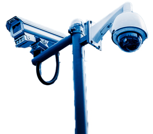
SPD’s CCTV Cameras Observable Distance
At 6,014 feet (1.1 mi) they can determine whether or not an individual is present
At 2,385 feet they can determine how many people are present and to see characteristic details of individuals, such as distinctive clothing
At 1,200 feet they can determine whether or not an individual shown is the same as someone they have seen before
At 600 feet they can identify an individual
(However, this only includes what is in their “line of sight”)
Stop Surveillance City is the group responsible for figuring out the strength, resolution, and capabilities in real-terms for us.
Data for this map is being drawn from
Seattle Depart. of Transportation (SDOT)
Washington Depart. of Transportation (WSDOT)
Seattle Police Department (SPD)
City of Seattle (COS)
Grassroots or First Hand Accounts
Other Useful Links
https://stopsurveillancecity.wordpress.com/2025/09/07/how-far-can-spds-cameras-see-cid-edition/
https://www.seattle.gov/police/community-policing/community-programs/cctv
https://sdotblog.seattle.gov/2023/12/01/dont-block-the-box-traffic-cameras/
https://wsdot.com/Travel/Real-time/Map/?featuretype=camera&featureid=10125